Prevention of, and preparation for, spills of hazardous materials is a critical element in maintaining the multiple uses of the river
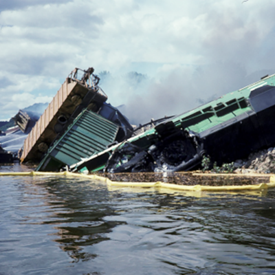
Numerous pipelines, roads, and railways cross or run parallel to the Upper Mississippi River. The potential for hazardous spills poses a significant risk to the river’s diverse natural resources, including water supply, industry, transportation, and recreation. The coordination of quick notification and response by all relevant federal, state, local, and private entities is essential to minimize the damages from a spill of a hazardous substance on the river. Even though spill occurrences on the Upper Mississippi have been relatively limited, emergency preparedness and coordinated response to contain and clean up the spills have paid tremendous dividends.
Key Documents and Links
Inland Sensitivity Atlas (ISA)
Spill Response Plan and Resource Manual
Hazardous Spills Coordination Group
Staff Contact
Mark Ellis
Priority Solutions
UMRBA works directly with emergency responders and resource trustees (i.e., parties with legal responsibilities to monitor and protect natural resources) to coordinate spill response. This includes facilitating information sharing and planning, providing mapping and other planning and response tools, and advocating for federal investment and resources.
UMRBA History
Since 1989, the UMRBA has provided staff support for the Upper Mississippi River Hazardous Spills Coordination Group (UMR Spills Group), which includes representatives of state and federal agencies who play a role in contingency planning and spill response on the river. The UMR Spills Group provides a forum for interagency coordination, serves as a voice for the region's spill responders on various issues, and helps in the preparation and execution of training activities.
Among the Group's accomplishments are development and maintenance of the Upper Mississippi River Spill Response Plan and Resource Manual, which has been adopted by the state and federal agency members of the UMR Spills Group. The UMR Plan is designed to complement broader regional and national contingency plans by addressing issues and concerns related specifically to spill response on the Upper Mississippi River. The Plan includes a resource manual which contains information about potential spill sources, vulnerable resources, and response assets.
UMRBA also engages in an extensive contingency planning and mapping project funded largely by the U.S. Environmental Protection Agency Region 5. This work has its foundation in the Oil Pollution Act (OPA) of 1990 and has been ongoing since 1992. Products include geographic information system-based sensitivity atlases for the Region 5 states (Illinois, Minnesota, Wisconsin) and UMR counties within Iowa and Missouri as well as contingency plans for several metropolitan areas and National Wildlife Refuges in the region. Recently, UMRBA partnered with the National Park Service to assess the risk of a hazardous spill within the St. Croix National Scenic Riverway and develop contingency plans and response strategies.


